Vuurtoren in Engeland - English Lighthouse - Gegevens - Informatie - Overzicht van Engelse Vuurtorens
Vuurtoren in Engeland
_______________________________________________________________________________
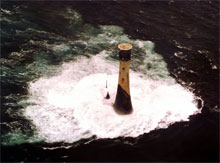
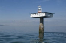
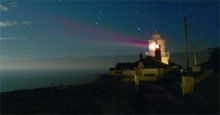
De kust van Engeland is op veel plaatsen gevaarlijk en verradelijk. Niet gek dat er in de 19e en het begin van de 20e eeuw een groot aantal vuurtorens is gebouwd aan de Engelse kust. Op deze pagina vindt u het overzicht van vuurtorens in Engeland ingedeeld naar gebied. Het grootste gedeelte van deze Engelse vuurtorens worden op dit moment onderhouden door de Trinity House Lighthouse organisatie.
_______________________________________________________________________________
_______________________________________________________________________________
- Godrevy (Godrevy Island) 50° 14.559' N 005° 24'.011' W (1859)
- Lizard (Lizard Point) 49° 57.612' N 005° 12.128' W (1619)
- Longships (Land's End) 50° 04.012' N 005° 44.812' W (1795)
- Pendeen (Pendeen Watch) 50° 09.899' N 005° 40.295' W (1900)
- St. Anthony's (Falmouth) 50 08'.469 N 005 00'.964 W (1835)
- Tater Du (Penzance) 50° 03’.143 N 005° 34’.647 W (1965)
- Trevose Head (Trevose HEad) 50° 32'.954 N 005° 02'.113 W (1847)
- Wolf Rock (Wolf Rock) 49° 56'.719 N 005° 48'.550 W (1861)
De vuurtorens op de Scilly-eilanden (Isles of Scilly) zijn apart vermeld.
_______________________________________________________________________________
_______________________________________________________________________________
St. Bees (Maryport) 54° 30'.818 N 003° 38'.205 W (1718)
_______________________________________________________________________________
_______________________________________________________________________________
- Berry Head (Berry Head) 50° 23.974' N 003° 29.006' W (1906)
- Bull Point (Bull Point) 51° 11.946' N 004° 12.074' W (1879)
- Eddystone (Eddystone Rocks) 50° 10.843' N 004° 15’.936 W (1698)
- Lundy Island North (eiland Lundy) 51° 12.104' N 004° 40.640' W (1897)
- Lundy Island South (eiland Lundy) 51° 09.723' N 004° 39.351' W (1897)
- Lynmouth Foreland (Lynmouth) 51° 14.731' N 003° 47.201' W (1900)
- Hartland Point (Harland Point) 51° 01.326' N 004° 31.530' W (1874)
- Smeaton's Tower (Plymouth Hoe) 50.36441° N 4.14183° W (1877)
- Start Point (Start Point) 50° 13'.344 N 003° 38'.539 W (1836)
_______________________________________________________________________________
_______________________________________________________________________________
- Portland Bill (eiland Portland) 50° 30'.848 N 002° 27'.384 W (1716)
_______________________________________________________________________________
_______________________________________________________________________________
- Beachy Head (Beacy Head) 50° 44.025' N 000° 14.488' E (1902)
- Royal Sovereign (Royal Sovereign Shoal) 50° 43'.454 N 000° 26'.086 E (1875)
_______________________________________________________________________________
_______________________________________________________________________________
- Flamborough (Flamborough Head) 54° 06.980' N 000° 04.962' W (1669)
_______________________________________________________________________________
_______________________________________________________________________________
- Hurst Point (Hurst Point) 50° 42.478' N 001° 33.023' W (1786)
_______________________________________________________________________________
_______________________________________________________________________________
- Dungeness (Dungeness) 50° 54.806' N, 000° 58.560' E (1792)
_______________________________________________________________________________
_______________________________________________________________________________
- Hilbre Island (Hilbre, Hoylake) 53° 23.000' N 003° 13.710' W (1927)
_______________________________________________________________________________
_______________________________________________________________________________
- Cromer (Cromer) 52° 55'.482 N 001° 18'.990 E (1680)
_______________________________________________________________________________
_______________________________________________________________________________
- Whitby (Whitby) 54° 28'.667 N 000° 34'.094 W (1858)
_______________________________________________________________________________
_______________________________________________________________________________
- Coquet (Coquet Island) 55° 20.033' N 001° 32.387' W (1841)
- Farne (Farne Islands) 55° 36.921' N 001° 39.346 W (1811)
- Longstone (Outer Farne) 55° 38.623' N 001° 36.653' W (1826)
_______________________________________________________________________________
_______________________________________________________________________________
- Bishop Rock (Bishop Rock) 49° 52.371' N 006° 26.734' W (1858)
- Peninnis (St. mary's Island) 49° 54.273' N 006° 18.221' W (1911)
- Round Island (Round Island) 49° 58.739 N 006° 19.387 W (1887)
_______________________________________________________________________________
_______________________________________________________________________________
- Lowestoft (Lowestoft) 52° 29.223' N 001° 45'.353' W (1609)
_______________________________________________________________________________
_______________________________________________________________________________
- The Needles (Alum Bay) 50° 39.734' N 001° 35.500' W (1786)
- St. Catherine's (Niton Undercliffe) 50° 34'.539 N 001° 17'.873 W (1325)
- Nab Tower (Nab Rocks) 50° 40.075' N 000° 57'.155' W (1920)
_______________________________________________________________________________